Compartida por: Diana Schreckenberger
0 votos
| 3647 | Planeación Interactiva de educación básica | ||||||||
| Nivel escolar | Primaria | Grado escolar | 2do grado | Asignatura | Inglés | Bloque | V | Semana | 36a |
| Tema | Difundir información mediante recursos gráficos | ||||||||
| Competencia a desarrollar | Registrar información básica de un tema de Geografía con apoyo de un gráfico | Duración | 0 horas, 50 minutos | ||||||
| Aprendizaje esperado | Reconoce propósito y tema a partir de ilustraciones y datos | ||||||||
| Etapas | Tiempo sugerido | Secuencia didáctica | MED | Página libro de texto | |||||
| Inicio | 00:05 | 1. T, say hello as you do following your regular routine. Pirates in the Caribbean visiting various islands will be the way to start today. T, Print the Welcome to the Caribbean mini poster to illustrate your warm up. Link in the “recursos” column. Ask Ss if they know what a pirate is. |
|
||||||
| Desarrollo | 00:40 | 2. Have Ss work in pairs during the whole session to stimulate conversation between them. Give Ss the worksheets to draw a pirate face and color a pirate ship. Ask them to give the pirate a name. 2. Do the same with the ship, give it a name. 10’ Links in the “recursos” column Take them to the Historical map to zoom in and show them the islands of the Caribbean. Locate Tortuga island; mention for example this is the island where Captain Jack Sparrow from the Movie Pirates of the Caribbean goes looking for treasures. 5’ 3. Show them the real pirates of the Caribbean map and point at the different places where pirates went to. 5’ T, read ahead so you get familiarized with the names of the real pirates shown in this page to be able to tell about them to your Ss. There is also a web page, which is resource for you. You can get more information about the islands mentioned in the film and the rest of the islands in the Caribbean. Talk about the information to SS. 5’ Link in the “recursos” column. 4. Ask Ss to choose two islands and write the names of those islands on the ship worksheet they colored at the beginning of the session. 5’ T, there are two links in the “recursos” column, one with a map for Ss and the other with the answer key. You’ll have to have the map printed and ready for your SS to solve the next session. Have Ss talk about their favorite Caribbean island, what they think is the weather like, what fruits they can find in the islands etc. 10’ |

Map of the Caribbean islands answer key 
Historical map 
Pirate face to color 
Map of the Caribbean islands 
List of locations of Pirates of the Caribbean. Wiki page 
Real pirates of the Caribbean map 
Pirate ship to color. 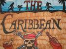
Welcome to the Caribbean mini poster
|
||||||
| Cierre | 00:05 | 5. T, say goodbye with your regular routine. Remember to pick up all worksheets from your Ss and place in a folder specific of each one of them. Give them a pirate’s worksheet for them to cut at home so they can bring it back the next session and decorate their Caribbean islands map. Link in the Recursos column |

Worksheet to decorate map
|
||||||
| Evaluación | • Identify graphic and written components. • Locate North, Central and South America. • Identify data or information aboct countries located in the American continent. • Explore maps of the American continent with information such as language, coin and flag of each country etc. • Point to countries on the American continent and recognize them when hearing their name. • Pronounce the names of countries for practice. • Recognize words similar to those of their mother tongue. • Write the names of regions and countries of the American continent following a model. • Complete sentences from a group of words. • Upper and lower cap letters. • Getting to know and appreciate linguistic diversity. | ||||||||
Compartida por: Diana Schreckenberger
0 votos
| 3648 | Planeación Interactiva de educación básica | ||||||||
| Nivel escolar | Primaria | Grado escolar | 2do grado | Asignatura | Inglés | Bloque | V | Semana | 36b |
| Tema | Difundir información mediante recursos gráficos | ||||||||
| Competencia a desarrollar | Registrar información básica de un tema de Geografía con apoyo de un gráfico | Duración | 0 horas, 50 minutos | ||||||
| Aprendizaje esperado | Reconoce propósito y tema a partir de ilustraciones y datos | ||||||||
| Etapas | Tiempo sugerido | Secuencia didáctica | MED | Página libro de texto | |||||
| Inicio | 00:05 | 1. T, say hello as you do following your regular routine. Give Ss the map of the Caribbean islands you have ready from last session. |
|
||||||
| Desarrollo | 00:40 | 2. Work in teams. Ask Ss to write on the worksheet as many names of the islands as they can remember in 5’ Help them complete the worksheet and then ask them to decorate their work with the items they cut out from the worksheet you gave them last session. Ask them to place the treasure chest in the Bahamas, the pirates close to Haiti; the palm tree; diamond, pearl and bird by Cuba and the rest in any way they want. 15’ Give Ss their passports. Have Ss write the name of at least three islands in the Caribbean on their passports. 5’ Have Ss play a game of guessing the country, they go to the side and click on the country they hear. They can count the score; make sure they play all Central and South America. 15’ |

19 Countries of Central and South America
|
||||||
| Cierre | 00:05 | 3. T, say goodbye with your regular routine. Remember to pick up all worksheets from your Ss and place in a folder specific of each one of them. Make sure all worksheets have a perforation on the upper left corner so they can put their book together. |
|
||||||
| Evaluación | • Identify graphic and written components. • Locate North, Central and South America. • Identify data or information aboct countries located in the American continent. • Explore maps of the American continent with information such as language, coin and flag of each country etc. • Point to countries on the American continent and recognize them when hearing their name. • Pronounce the names of countries for practice. • Recognize words similar to those of their mother tongue. • Write the names of regions and countries of the American continent following a model. • Complete sentences from a group of words. • Upper and lower cap letters. • Getting to know and appreciate linguistic diversity. | ||||||||
Compartida por: Diana Schreckenberger
0 votos
| 3649 | Planeación Interactiva de educación básica | ||||||||
| Nivel escolar | Primaria | Grado escolar | 2do grado | Asignatura | Inglés | Bloque | V | Semana | 36c |
| Tema | Difundir información mediante recursos gráficos | ||||||||
| Competencia a desarrollar | Registrar información básica de un tema de Geografía con apoyo de un gráfico | Duración | 0 horas, 50 minutos | ||||||
| Aprendizaje esperado | Reconoce propósito y tema a partir de ilustraciones y datos | ||||||||
| Etapas | Tiempo sugerido | Secuencia didáctica | MED | Página libro de texto | |||||
| Inicio | 00:05 | 1. T, say hello as you do following your regular routine. Tell Ss today they are going to put together a book of all the worksheets they have worked on during the last sessions. |
|
||||||
| Desarrollo | 00:40 | 2. Give Ss their folders with all their worksheets and walk them through the process of putting their books together. They need to write their name and grade on the book cover; and connect all the worksheets through the hole on the top left corner to hold them together. The first sheet is the construction paper which will work as the back of the cover. The Ziplock bag to hold the passport goes next and all the worksheets follow. The last page is the book cover. 15’ Ask Ss to help you place their books in the classroom together with the map made with foam. The map can be placed inside a plastic bag to be used when necessary. 5’ 3. When they finish then have them visit the kbears web page to explore and have fun. 20’ T, you’ll find maps, music; coloring pages and games. Make sure not to click where it says Teachers, Parents: We have a site for you too! The music part of the site is very good and the games are fun. Enjoy! |

Kbears website
|
||||||
| Cierre | 00:05 | 4. T, say goodbye with your regular routine. |
|
||||||
| Evaluación | Identify graphic and written components - Locate North, Central and South America - Identify data or information about countries located in the American Continent - Explore maps of the American Continent with information such as language, coin and flag of each country etc. - Point to countries on the American Continent and recognize them when hearing their name - Pronounce the names of countries for practice - Recognize words similar to those of their mother tongue - Write the names of regions and countries of the American Continent following a model - Complete sentences from a group of words - Upper and lower cap letters Getting to know and appreciate linguistic diversity | ||||||||

