Compartida por: Diana Schreckenberger
0 votos
| 3644 | Planeación Interactiva de educación básica | ||||||||
| Nivel escolar | Primaria | Grado escolar | 2do grado | Asignatura | Inglés | Bloque | V | Semana | 35a |
| Tema | Difundir información mediante recursos gráficos | ||||||||
| Competencia a desarrollar | Registrar información básica de un tema de Geografía con apoyo de un gráfico | Duración | 0 horas, 50 minutos | ||||||
| Aprendizaje esperado | Reconoce propósito y tema a partir de ilustraciones y datos | ||||||||
| Etapas | Tiempo sugerido | Secuencia didáctica | MED | Página libro de texto | |||||
| Inicio | 00:05 | 1. T, say hello as you do following your regular routine. Give Ss their passport. Today they’ll write the names of the various countries of the American continent on their passport. |
|
||||||
| Desarrollo | 00:40 | 2. Tell Ss today they’ll start traveling through the American continent. ß T, organize the countries in alphabetical order. To start they can play a game of countries of Central and South America. There are 20 countries where they can click on and information on the country will appear on the screen. This is a page with sound so make sure they repeat the name of the country they click on, and read all the information about the various countries. 20’ When Ss finish with the computer activity let them listen to a song shown in a video. Link in the “recursos” column This video has all the countries of the Caribbean region and it lasts about 4’. T, I’m including a link to a PP presentation about Central America and Caribbean for you to choose any information you think your Ss will be interested on. 3. Working in teams: Have Ss write on their passports, the names of the countries they studied today and talk about what they would like to know about those countries. 15’ T, there is a link to a Mega Maps site where you can print each map of the American continent on “foamy” sheets, cut and have them ready for other sessions. |

Countries of the world video 
19 Countries of Central and South America 
.Mega Maps 
Central America and Caribbean PPpresentation
|
||||||
| Cierre | 00:05 | 4. T, say goodbye with your regular routine. Remember to pick up all worksheets from your Ss and place in a folder specific of each one of them. |
|
||||||
| Evaluación | • Identify graphic and written components. • Locate North, Central and South America. • Identify data or information aboct countries located in the American continent. • Explore maps of the American continent with information such as language, coin and flag of each country etc. • Point to countries on the American continent and recognize them when hearing their name. • Pronounce the names of countries for practice. • Recognize words similar to those of their mother tongue. • Write the names of regions and countries of the American continent following a model. • Complete sentences from a group of words. • Upper and lower cap letters. • Getting to know and appreciate linguistic diversity. | ||||||||
Compartida por: Diana Schreckenberger
0 votos
| 3645 | Planeación Interactiva de educación básica | ||||||||
| Nivel escolar | Primaria | Grado escolar | 2do grado | Asignatura | Inglés | Bloque | V | Semana | 35b |
| Tema | Difundir información mediante recursos gráficos | ||||||||
| Competencia a desarrollar | Registrar información básica de un tema de Geografía con apoyo de un gráfico | Duración | 0 horas, 50 minutos | ||||||
| Aprendizaje esperado | Reconoce propósito y tema a partir de ilustraciones y datos | ||||||||
| Etapas | Tiempo sugerido | Secuencia didáctica | MED | Página libro de texto | |||||
| Inicio | 00:05 | 1. T, say hello as you do following your regular routine. Have the shapes of the countries cut out and ready for Ss to use. Each country needs to have its name on it. Today Ss are going to “fly” to the various countries in America. |
|
||||||
| Desarrollo | 00:40 | 2. Place the maps of the continent on the table. Ss start playing a “click and drag” computer game. Choose the area of America they’ll be working with. If they have the skills and abilities to work with all of them please feel free to have them do so. Link in the “recursos” column. 10’ 3. Have Ss choose three countries to visit in the page Countries in American continent / capitals and flags and click on “Map of…” Divide the group in teams and have them talk about what they found about each one of the countries they visited. 10’ 4. Place the map of Mexico on the floor sot it becomes the starting point for SS to place the rest of the continents. 10’ 5. Have Ss visit the page Flags of the American continent where they can find a description of each flag. Ss will have to find the description corresponding to the flag of the countries they visited. 10’ |

Flags of the American continent. Flag description 
Maps click and drag 
Countries in American continent / capitals and flags
.Mega Maps
|
||||||
| Cierre | 00:05 | 6. T, say goodbye with your regular routine. |
|
||||||
| Evaluación | • Identify graphic and written components. • Locate North, Central and South America. • Identify data or information aboct countries located in the American continent. • Explore maps of the American continent with information such as language, coin and flag of each country etc. • Point to countries on the American continent and recognize them when hearing their name. • Pronounce the names of countries for practice. • Recognize words similar to those of their mother tongue. • Write the names of regions and countries of the American continent following a model. • Complete sentences from a group of words. • Upper and lower cap letters. • Getting to know and appreciate linguistic diversity. | ||||||||
Compartida por: Diana Schreckenberger
0 votos
| 3646 | Planeación Interactiva de educación básica | ||||||||
| Nivel escolar | Primaria | Grado escolar | 2do grado | Asignatura | Inglés | Bloque | V | Semana | 35c |
| Tema | Difundir información mediante recursos gráficos | ||||||||
| Competencia a desarrollar | Registrar información básica de un tema de Geografía con apoyo de un gráfico | Duración | 0 horas, 50 minutos | ||||||
| Aprendizaje esperado | Reconoce propósito y tema a partir de ilustraciones y datos | ||||||||
| Etapas | Tiempo sugerido | Secuencia didáctica | MED | Página libro de texto | |||||
| Inicio | 00:05 | 1. T, say hello as you do following your regular routine. Today Ss will find the flags of Lating American countries |
|
||||||
| Desarrollo | 00:40 | Ss visit the page Country facts. Identifying Latin American countries. Once they are on the page they will have to identify and write down on their passports, the names of the Latin American countries they find. They should find about eleven countries. 10’ They visit the page Flags of Latin American countries. Print and color, there they choose the flag of one country to print and color. 15’ T, listen to the Latin American civilizations recording. Explain to your Ss the content of the information in this listening exercise so they have a listening experience by listening to what you tell them; if they need help understanding the content use mimic and full body language as well as drawings on the board. Ask a few questions to make sure they understood the content of your conversation. 10 to 15’ depending on the skills and abilities of your Ss. |

Country facts. Identifying Latin American countries 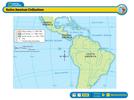
Latin American Civilizations 
Flags of Latin American countries. Print and color
|
||||||
| Cierre | 00:05 | T, say goodbye with your regular routine. Remember to pick up all worksheets from your Ss and place in a folder specific of each one of them. |
|
||||||
| Evaluación | • Identify graphic and written components. • Locate North, Central and South America. • Identify data or information aboct countries located in the American continent. • Explore maps of the American continent with information such as language, coin and flag of each country etc. • Point to countries on the American continent and recognize them when hearing their name. • Pronounce the names of countries for practice. • Recognize words similar to those of their mother tongue. • Write the names of regions and countries of the American continent following a model. • Complete sentences from a group of words. • Upper and lower cap letters. • Getting to know and appreciate linguistic diversity. | ||||||||

